
Here’s the problem most utility drawings don’t tell you: they look equally confident no matter how the data was actually collected. A line pulled from a 1990s record drawing shows up on the plan looking exactly as certain as a utility that was physically exposed and measured last week. If you’re designing around that line, or excavating near it, that difference matters more than almost anything else on the drawing.
ASCE 38 exists to close that gap. It’s a standard that classifies underground utility data by how it was obtained, not just where it appears on a map, so a project team can tell the difference between “we think it’s here” and “we confirmed it’s here.” This article explains what the four ASCE 38 quality levels actually mean, where Canada’s own CSA S250 fits in, and how to figure out which level your project actually needs before something goes wrong in the field.
The Short Answer
ASCE 38 defines four data quality levels, D through A. QL-D comes from records alone. QL-C adds a visible surface survey. QL-B uses geophysical equipment like GPR to locate utilities without digging. QL-A is the highest level, achieved by physically exposing the utility, most commonly through vacuum excavation. In Canada, CSA S250 works alongside ASCE 38 to guide how that data should be recorded and managed. A standard utility locate, the kind required before excavation under Ontario’s O. Reg. 213/91, generally gives you QL-C or QL-D confidence. It does not reliably confirm exact depth. That’s the certainty gap this article is built around.
Why This Matters Before You Design or Dig
Two different things get confused constantly on Canadian projects: having a locate, and knowing how good your utility data actually is.
Ontario’s Ministry of Labour is clear that before any excavation, all gas, electrical, and other services in the work area have to be located and marked, and that locates are generally valid for 30 days from the date of completion. That’s a legal safety requirement under O. Reg. 213/91, and it’s non-negotiable before digging starts. But it answers a narrower question than most people assume: it tells you a utility is likely present and roughly where. It doesn’t tell you the exact depth, and it wasn’t designed to.
If your project is deciding how close a bore path can safely pass a gas main, or routing a new watermain through a congested downtown corridor, “roughly where” isn’t good enough. That’s the moment ASCE 38’s quality levels become useful, because they let you ask a more specific question: is this data good enough for what I’m about to do with it?
The Four Quality Levels
QL-D: What the Records Say – QL-D comes from existing utility owner maps, as-built drawings, or oral recollection. No fieldwork, no verification. It’s the right level for early planning and route selection, when you’re comparing options, not committing to a final design. It’s also the level most prone to being wrong, since a utility that was never properly recorded simply won’t appear at all.
QL-C: What You Can See – QL-C adds a surface survey of visible features, manholes, valve boxes, catch basins, and correlates that against the QL-D records. It narrows things down but still relies on inference. A visible manhole tells you a sewer runs nearby. It doesn’t tell you its exact path or depth.
QL-B: What Geophysical Equipment Finds – QL-B uses surface geophysical methods, most commonly ground penetrating radar and electromagnetic locating, to determine the existence and approximate horizontal position of utilities across a project area. This is generally the working level for detailed design and conflict avoidance planning. It’s reliable for horizontal position across a wide area, but it typically doesn’t confirm exact depth with confidence, especially in congested ground with multiple utilities close together.
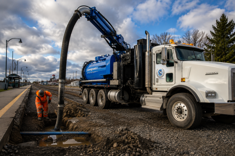
QL-A: What You’ve Actually Confirmed – QL-A is the highest level defined by the standard, and there’s only one way to get there: physically expose the utility and measure it directly. This is most commonly done through vacuum excavation, sometimes called daylighting, where a small test hole is opened without mechanical contact and the utility’s exact horizontal and vertical position is recorded. Because it’s a direct physical confirmation rather than an inference from equipment or records, QL-A significantly reduces the uncertainty the other three levels still carry. It’s also the same confirmation method used for potholing ahead of horizontal directional drilling, where confirming exact utility position before a bore path is finalized matters just as much.
How CSA S250 Fits In for Canadian Projects
ASCE 38 comes from the American Society of Civil Engineers, but it isn’t the only relevant standard in Canada. CSA S250, published by CSA Group in 2011 and updated since, was developed specifically to work alongside ASCE 38, not replace it. Where ASCE 38 classifies how reliable the data is, CSA S250 focuses more on how that data should be recorded, mapped, and managed over time, so utility information stays usable and accurate for future projects, not just the one it was collected for.
On Canadian projects, it’s increasingly common to see both standards referenced together. If a project specification or consulting engineer cites ASCE 38, it’s worth asking whether CSA S250’s record-keeping expectations apply too.
Worth being precise here: unlike O. Reg. 213/91, neither ASCE 38 nor CSA S250 is a government regulation. They’re industry and standards-body publications. Nothing in Ontario law currently mandates a specific quality level for a given project type. They’re used because the industry has adopted them as a shared, credible framework, not because a government body requires them.
Matching the Quality Level to the Actual Decision
If you’re still choosing a route or comparing design options, QL-D or QL-C is usually enough. You’re not committing to exact positioning yet.
If you’re finalizing a design and need reliable coverage across the whole site, QL-B is generally the right working standard. It’s efficient and gives you a dependable horizontal picture.
If there’s a specific point where the stakes are high, a proposed structure crossing a gas main, a bore path passing close to fibre or hydro, a congested corridor with multiple utilities stacked close together, that specific point needs QL-A. You don’t need to daylight an entire project. You need to daylight the points where being wrong would actually cost you.
A useful way to frame it: QL-B tells you where to be careful. QL-A tells you exactly what you’re dealing with at the one or two points where “careful” isn’t enough.
Where Vacuum Excavation Comes In
Getting to QL-A means physically exposing the utility, and vacuum excavation is the standard method used to do it, for the same non-contact reasons described above. It doesn’t mean every excavation needs vacuum excavation to meet locate requirements. It means that when a specific point on your project genuinely needs QL-A certainty, this is the method that gets you there. The same logic applies during trenching and excavation work near known utilities, where confirming exact position first protects both the schedule and the crew.
Utility Data Quality Levels at a Glance
| Quality Level | Reliability | Method | Right for |
| QL-D | Lowest | Existing records, oral recollection | Early planning, route selection |
| QL-C | Low to moderate | Visible surface survey correlated with records | Preliminary design |
| QL-B | Moderate to high | Surface geophysical methods (GPR, electromagnetic) | Detailed design, conflict avoidance |
| QL-A | Highest | Physical exposure via vacuum excavation | Critical crossings, congested corridors, high-risk conflict points |
A Quick Way to Check Your Project
- Are you still comparing routes or options? QL-D or QL-C is likely enough for now.
- Are you finalizing design and need reliable coverage across the site? QL-B is generally the standard to work from.
- Is there a specific point where a new structure or bore path comes close to an existing utility? That point needs QL-A, even if the rest of the project doesn’t.
- Do you have a valid, current locate? Confirm that separately. A locate satisfies a legal safety requirement under O. Reg. 213/91. It’s not the same thing as confirming your data quality level.
- Does your project spec reference ASCE 38? Check whether CSA S250’s record-keeping requirements apply as well.